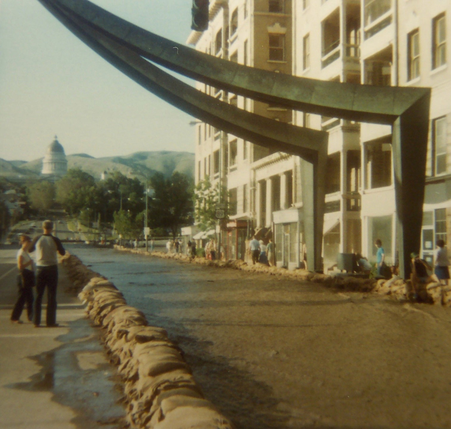
The Historic Flood Threat
In the spring of 1983, rapid snowmelt across the Wasatch Range combined with heavy rainfall to overwhelm Salt Lake City's stormwater system. A major underground trunk line carrying runoff from the foothills through the city's downtown core became jammed with rocks and debris, and floodwaters spilled onto the streets. State Street, the main north-south artery through downtown, became a canal. Thousands of volunteers mobilized to sandbag along State Street and protect Temple Square while the city worked to clear the blockage.
The event left a permanent mark on how the city thinks about this corridor. The underground pipe that carries City Creek runoff from the foothills through the heart of downtown is not a routine drainage channel; it is critical infrastructure for one of the most historically and commercially significant areas in the Intermountain West.
The Engineering Challenge
More than two decades after the 1983 flood, a major Salt Lake area municipality engaged me to build a dynamic hydraulic model of the same system to support capital improvement planning. The question wasn't just whether the pipe had capacity: it was where the system begins to pressurize, when surcharge onset occurs during a design storm, and what the consequences are at the surface when it does. A static capacity check cannot answer those questions. A dynamic model can.
I built EPA SWMM models for two major trunk lines: the primary corridor carrying snowmelt and storm runoff from the foothills through the downtown core to the Jordan River, and a second major east-west trunk line in the 900 South corridor, together covering two of the city's most critical underground stormwater conveyances. The project included surveying, utility mapping, hydrology, snowmelt modeling, and model calibration and many discussions with city engineers.
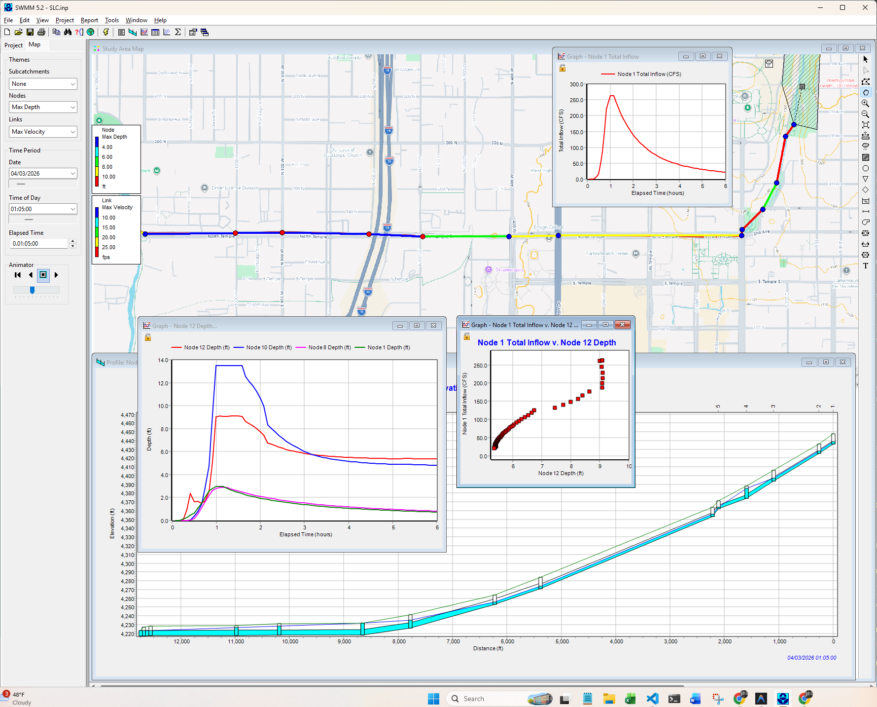
Model Visualization
What the Model Reveals
- Hydraulic grade line animation tracks the transition from gravity flow to pressurized surcharge in real time, identifying the specific locations and timing where the system goes over capacity during a design event
- Snowmelt-driven hydrology captures the seasonal flood mechanism that defines risk in the Wasatch Front urban environment: not just rainfall, but the compounding effect of accumulated snowpack releasing rapidly in spring
- Georeferenced mapping places hydraulic results in spatial context, allowing planners and decision-makers to connect model outputs directly to streets, intersections, and infrastructure
- Two-trunk-line scope provides a system-wide view of capacity constraints across the 900 South corridor and the primary downtown conveyance, enabling coordinated CIP prioritization rather than isolated pipe-by-pipe analysis
Tools & Methods
| Hydraulic model | EPA SWMM (dynamic simulation) |
| Hydrology | Snowmelt-driven tributary inflows, design storm events |
| Visualization | Animated HGL profile view, georeferenced background mapping |
| Purpose | Capital improvement planning, flood risk assessment |
| Geography | Salt Lake City urban core, Wasatch Front |
Beyond Hydraulics: Coupling EPA SWMM with Probabilistic Simulation
Hydraulic models like EPA SWMM are purpose-built for what happens inside the pipe. But infrastructure decisions rarely stop there: they involve uncertainty, water quality, regulatory risk, and long-range planning scenarios that a single deterministic run cannot address.
To bridge that gap, I developed a working DLL-based integration that links EPA SWMM directly with GoldSim, a probabilistic systems simulation platform. In this hybrid architecture, GoldSim acts as the master controller: it generates rainfall inputs (including stochastic storm sequences), calls the SWMM engine at each time step, and receives flow and volume results back in real time. GoldSim then uses those hydraulic outputs to drive contaminant mass transport, tracking pollutant buildup, washoff, and treatment through a bioswale and detention pond network.
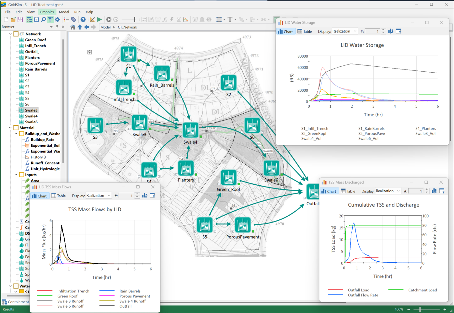
The result is a modeling framework that combines the hydraulic precision of EPA SWMM with GoldSim's ability to run Monte Carlo simulations across thousands of storm realizations, producing probabilistic estimates of pollutant loading, treatment performance, and exceedance risk. This approach is directly applicable to stormwater quality compliance work, NPDES permit support, and load reduction analysis under programs like Washington's Puget Sound TMDL requirements.
A full technical writeup of this integration, including downloadable model files, was published on the GoldSim technical blog:
* Disclaimer: The models and visual data presented on this page have been abstracted and recreated to protect critical municipal infrastructure and client confidentiality, conforming to standard professional engineering practices.